
Tataertag Fm
Type Locality and Naming
It was named by the 13th Party, Ministry of Geology in 1956 and published by the Compiling Group of the Stratigraphical Scale of the Xinjiang Uygur Zizhiqu in 1981. The type section is located at Dawuangou, 20 km northwest of Yin'gancun Village, Kalpin County, Xinjiang.
Synonym: (塔塔尔塔格组) , Tataertage Fm.
Lithology and Thickness
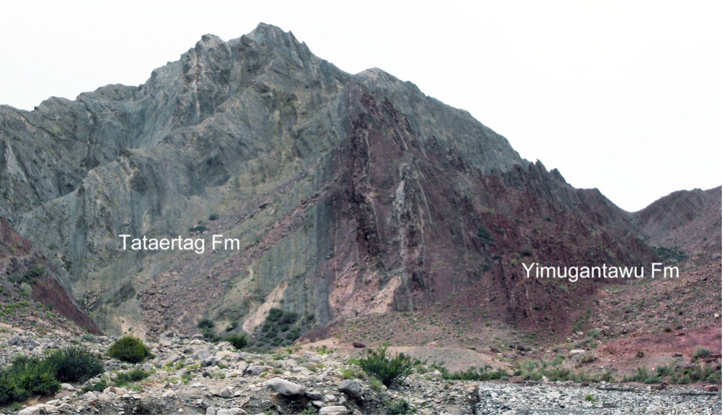
The formation is mainly composed of purple banded muddy siltstone, which might also be interbedded with grayish green muddy siltstone;the base of the formation consists of interbeds of purple sandstone with grayish green silty shale (Figure).
[Figure the lithology of, and the contact relationship between the Tataertag Fm and the Yimugantawu Fm at Tierekeawati, Kalpin, Xinjiang (Photography by Wang Guangxu)]
Relationships and Distribution
 Fm outcrops.jpg)
Upper contact
It rests conformably in between the overlying Yimugantawu Fm
Regional extent
It is comparatively steady in lithology and is exposed in Akqi and in the area from Kalpin to Bachu. The thickness of the formation varies from 156-279 m in general. On the eastern bank of Xiaohaizi Reservoir in Bachu it bears minor tuff and is 99 m in thickness. In the area of Akqi the formation, 170-280 m in thickness, partly yields cuprous sandstone lenses.
GeoJSON
Fossils
The upper part of the formation bears gastropod Horotogtum sp., chitinozoa Cingulochitina wronai, etc.
Age
Depositional setting
The formation represents a suit of mainly red, partly grayish green, clastic rock, belonging to littoral facies of platform type.
Additional Information